







7,000 years of history at risk in Belad-e Shapur
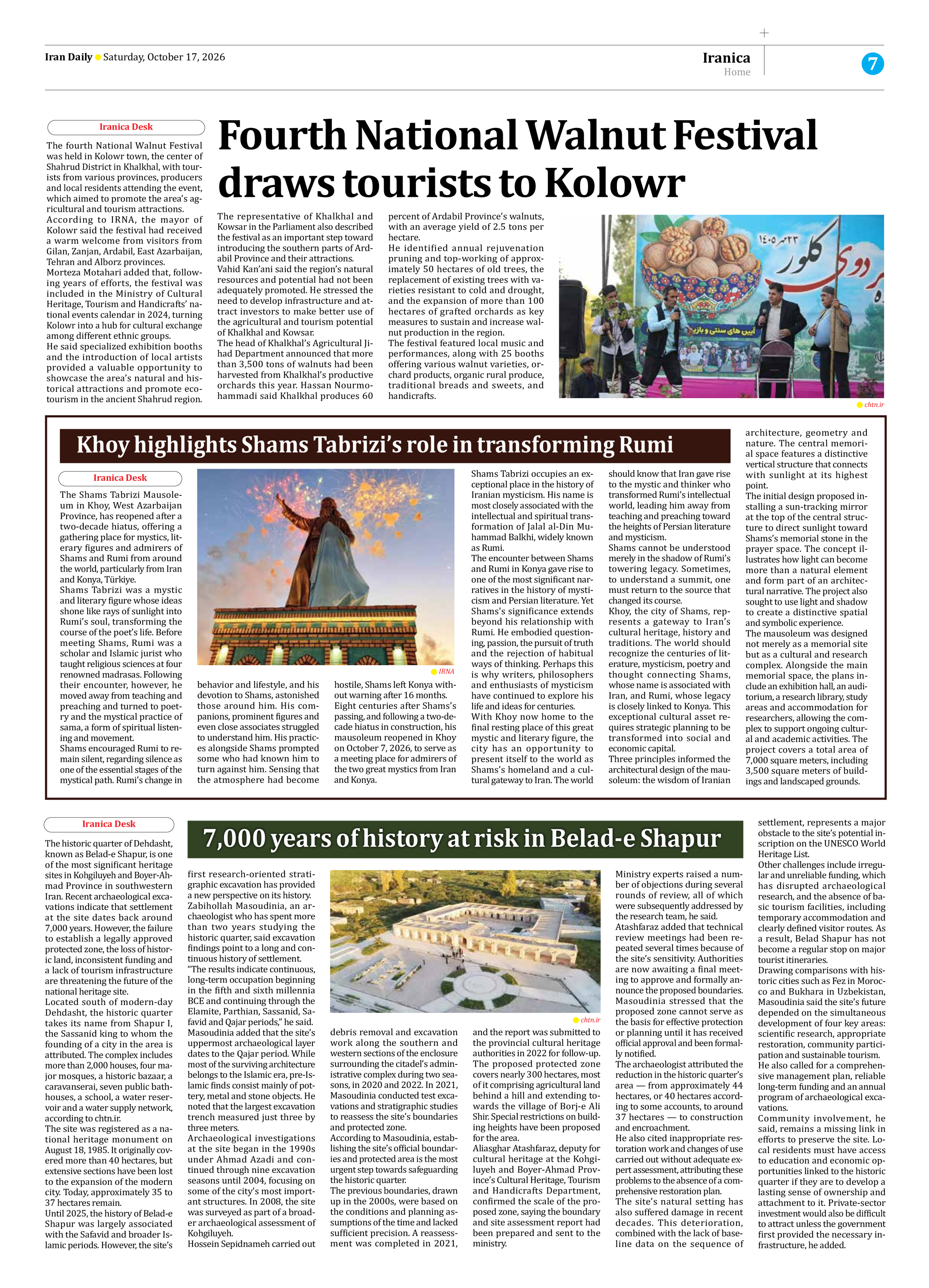
The historic quarter of Dehdasht, known as Belad-e Shapur, is one of the most significant heritage sites in Kohgiluyeh and Boyer-Ahmad Province in southwestern Iran. Recent archaeological excavations indicate that settlement at the site dates back around 7,000 years. However, the failure to establish a legally approved protected zone, the loss of historic land, inconsistent funding and a lack of tourism infrastructure are threatening the future of the national heritage site.
Located south of modern-day Dehdasht, the historic quarter takes its name from Shapur I, the Sassanid king to whom the founding of a city in the area is attributed. The complex includes more than 2,000 houses, four major mosques, a historic bazaar, a caravanserai, seven public bathhouses, a school, a water reservoir and a water supply network, according to chtn.ir.
The site was registered as a national heritage monument on August 18, 1985. It originally covered more than 40 hectares, but extensive sections have been lost to the expansion of the modern city. Today, approximately 35 to 37 hectares remain.
Until 2025, the history of Belad-e Shapur was largely associated with the Safavid and broader Islamic periods. However, the site’s first research-oriented stratigraphic excavation has provided a new perspective on its history.
Zabihollah Masoudinia, an archaeologist who has spent more than two years studying the historic quarter, said excavation findings point to a long and continuous history of settlement.
“The results indicate continuous, long-term occupation beginning in the fifth and sixth millennia BCE and continuing through the Elamite, Parthian, Sassanid, Safavid and Qajar periods,” he said.
Masoudinia added that the site’s uppermost archaeological layer dates to the Qajar period. While most of the surviving architecture belongs to the Islamic era, pre-Islamic finds consist mainly of pottery, metal and stone objects. He noted that the largest excavation trench measured just three by three meters.
Archaeological investigations at the site began in the 1990s under Ahmad Azadi and continued through nine excavation seasons until 2004, focusing on some of the city’s most important structures. In 2008, the site was surveyed as part of a broader archaeological assessment of Kohgiluyeh.
Hossein Sepidnameh carried out debris removal and excavation work along the southern and western sections of the enclosure surrounding the citadel’s administrative complex during two seasons, in 2020 and 2022. In 2021, Masoudinia conducted test excavations and stratigraphic studies to reassess the site’s boundaries and protected zone.
According to Masoudinia, establishing the site’s official boundaries and protected area is the most urgent step towards safeguarding the historic quarter.
The previous boundaries, drawn up in the 2000s, were based on the conditions and planning assumptions of the time and lacked sufficient precision. A reassessment was completed in 2021, and the report was submitted to the provincial cultural heritage authorities in 2022 for follow-up.
The proposed protected zone covers nearly 300 hectares, most of it comprising agricultural land behind a hill and extending towards the village of Borj-e Ali Shir. Special restrictions on building heights have been proposed for the area.
Aliasghar Atashfaraz, deputy for cultural heritage at the Kohgiluyeh and Boyer-Ahmad Province’s Cultural Heritage, Tourism and Handicrafts Department, confirmed the scale of the proposed zone, saying the boundary and site assessment report had been prepared and sent to the ministry.
Ministry experts raised a number of objections during several rounds of review, all of which were subsequently addressed by the research team, he said.
Atashfaraz added that technical review meetings had been repeated several times because of the site’s sensitivity. Authorities are now awaiting a final meeting to approve and formally announce the proposed boundaries.
Masoudinia stressed that the proposed zone cannot serve as the basis for effective protection or planning until it has received official approval and been formally notified.
The archaeologist attributed the reduction in the historic quarter’s area — from approximately 44 hectares, or 40 hectares according to some accounts, to around 37 hectares — to construction and encroachment.
He also cited inappropriate restoration work and changes of use carried out without adequate expert assessment, attributing these problems to the absence of a comprehensive restoration plan.
The site’s natural setting has also suffered damage in recent decades. This deterioration, combined with the lack of baseline data on the sequence of settlement, represents a major obstacle to the site’s potential inscription on the UNESCO World Heritage List.
Other challenges include irregular and unreliable funding, which has disrupted archaeological research, and the absence of basic tourism facilities, including temporary accommodation and clearly defined visitor routes. As a result, Belad Shapur has not become a regular stop on major tourist itineraries.
Drawing comparisons with historic cities such as Fez in Morocco and Bukhara in Uzbekistan, Masoudinia said the site’s future depended on the simultaneous development of four key areas: scientific research, appropriate restoration, community participation and sustainable tourism.
He also called for a comprehensive management plan, reliable long-term funding and an annual program of archaeological excavations.
Community involvement, he said, remains a missing link in efforts to preserve the site. Local residents must have access to education and economic opportunities linked to the historic quarter if they are to develop a lasting sense of ownership and attachment to it. Private-sector investment would also be difficult to attract unless the government first provided the necessary infrastructure, he added.