







Copy in clipboard...
Ancient Hesar-Dashtak road preserves legacy of Sassanid engineering
Fars Province, widely regarded as the cradle of ancient Iranian civilization, is home to countless archaeological treasures from the Achaemenid, Parthian, and Sassanid periods, many of which have been inscribed on Iran’s National Heritage List and the UNESCO World Heritage List.
Among the province’s most renowned historical landscapes is the Marvdasht Plain, where the ancient cities of Persepolis, Pasargadae, and Estakhr once flourished. Today, Persepolis, Pasargadae, Naqsh-e Rostam, and Naqsh-e Rajab are among Iran’s best-known archaeological sites, attracting large numbers of domestic and international visitors, particularly during the Nowruz holidays and the summer travel season, according to IRNA.
Yet these celebrated monuments represent only part of the region’s rich cultural heritage. Numerous lesser-known sites continue to offer remarkable opportunities for visitors interested in Iran’s ancient past.
One of these hidden treasures is the historic Hesar–Dashtak Road, located in the mountainous area of Dorudzan District in Marvdasht. The road lies approximately 600 meters northeast of Hesar village, on the slopes leading toward Dashtak village.
The ancient route was first identified during a preliminary survey conducted in 2016 as part of the research project Study of the Achaemenid Royal Road from Susa to Persepolis. Although the road has not yet undergone comprehensive archaeological investigation, available evidence suggests that it dates to the Sassanid and early Islamic periods. Its present name is derived from the neighboring villages of Hesar and Dashtak, between which it extends.
According to documentation prepared by the Fars Province’s Cultural Heritage, Tourism and Handicrafts Organization, the road served as an important passage for local communities over several centuries and underwent repeated repairs and continued use throughout its history.
Today, however, sections of the road have been damaged or destroyed by floods, landslides, and natural erosion. Despite these losses, substantial portions remain intact, offering adventurous travelers an opportunity to experience one of the region’s most remarkable but little-known archaeological landmarks.
Cultural heritage experts believe the road’s greatest significance lies in its sophisticated engineering. Its builders carefully controlled the steep mountain gradient, allowing travelers to ascend what is almost a vertical rocky slope with surprisingly little difficulty.
Constructed from two types of limestone — dense dark-gray stone and softer cream-colored limestone — the historic route stretches for about 750 meters. It is generally around two meters wide, although certain sections narrow to approximately one meter.
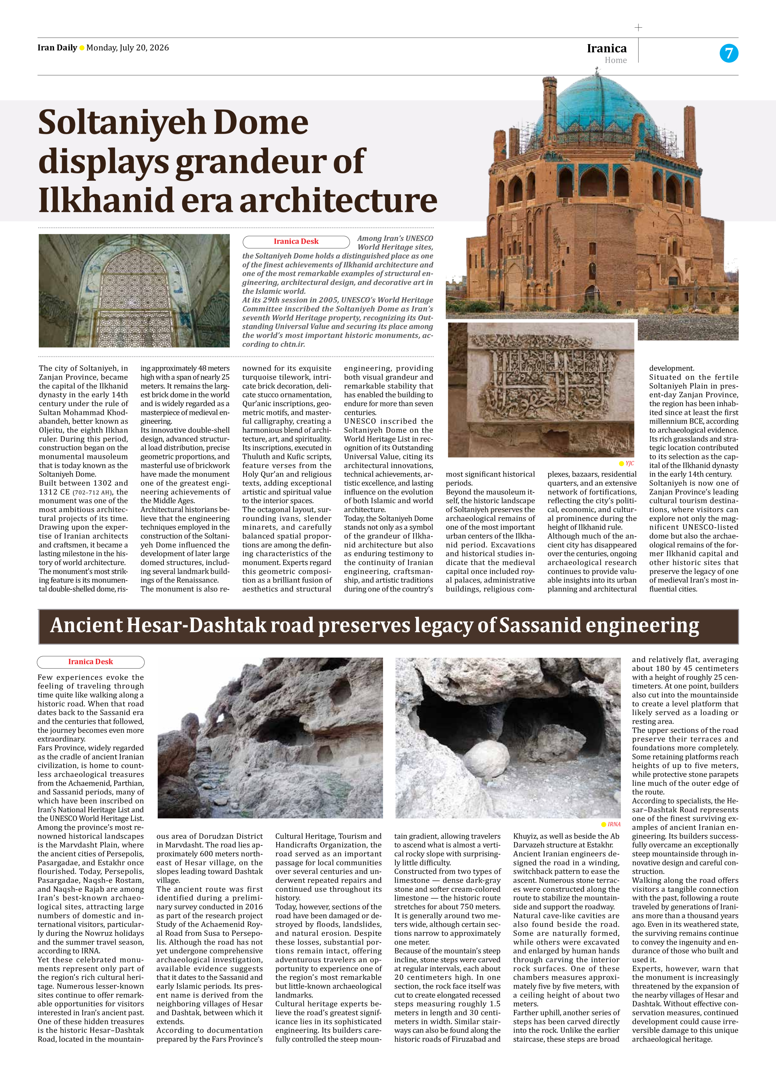
Because of the mountain’s steep incline, stone steps were carved at regular intervals, each about 20 centimeters high. In one section, the rock face itself was cut to create elongated recessed steps measuring roughly 1.5 meters in length and 30 centimeters in width. Similar stairways can also be found along the historic roads of Firuzabad and Khuyiz, as well as beside the Ab Darvazeh structure at Estakhr.
Ancient Iranian engineers designed the road in a winding, switchback pattern to ease the ascent. Numerous stone terraces were constructed along the route to stabilize the mountainside and support the roadway.
Natural cave-like cavities are also found beside the road. Some are naturally formed, while others were excavated and enlarged by human hands through carving the interior rock surfaces. One of these chambers measures approximately five by five meters, with a ceiling height of about two meters.
Farther uphill, another series of steps has been carved directly into the rock. Unlike the earlier staircase, these steps are broad and relatively flat, averaging about 180 by 45 centimeters with a height of roughly 25 centimeters. At one point, builders also cut into the mountainside to create a level platform that likely served as a loading or resting area.
The upper sections of the road preserve their terraces and foundations more completely. Some retaining platforms reach heights of up to five meters, while protective stone parapets line much of the outer edge of the route.
According to specialists, the Hesar–Dashtak Road represents one of the finest surviving examples of ancient Iranian engineering. Its builders successfully overcame an exceptionally steep mountainside through innovative design and careful construction.
Walking along the road offers visitors a tangible connection with the past, following a route traveled by generations of Iranians more than a thousand years ago. Even in its weathered state, the surviving remains continue to convey the ingenuity and endurance of those who built and used it.
Experts, however, warn that the monument is increasingly threatened by the expansion of the nearby villages of Hesar and Dashtak. Without effective conservation measures, continued development could cause irreversible damage to this unique archaeological heritage.