


Copy in clipboard...
Makran serving as watershed in promotion of blue economy
The ancient region of Makran located in the southeast of the Iranian plateau and on the northern shores of the Sea of Oman has been in the crosshairs of the enemies which coveted it for its resources or tried to choke off Iran’s access to its wealth throughout history, Press TV wrote.
Since 2008, when Leader of the Islamic Revolution Ayatollah Seyyed Ali Khamenei underlined the significance of Makran, saying the development of the region has been put on the frontline of Iran’s drive to reorient its economy.
The general policies of sea-based development call for a whole-of-government approach to develop Iran’s coasts, especially Makran beyond the strategic port of Chabahar.
The geopolitical, geostrategic and geoeconomic advantages of Makran hosting a comprehensive sea, road, rail and air transportation network along oil and gas transmission lines would enormously fortify Iran and upgrade its status.
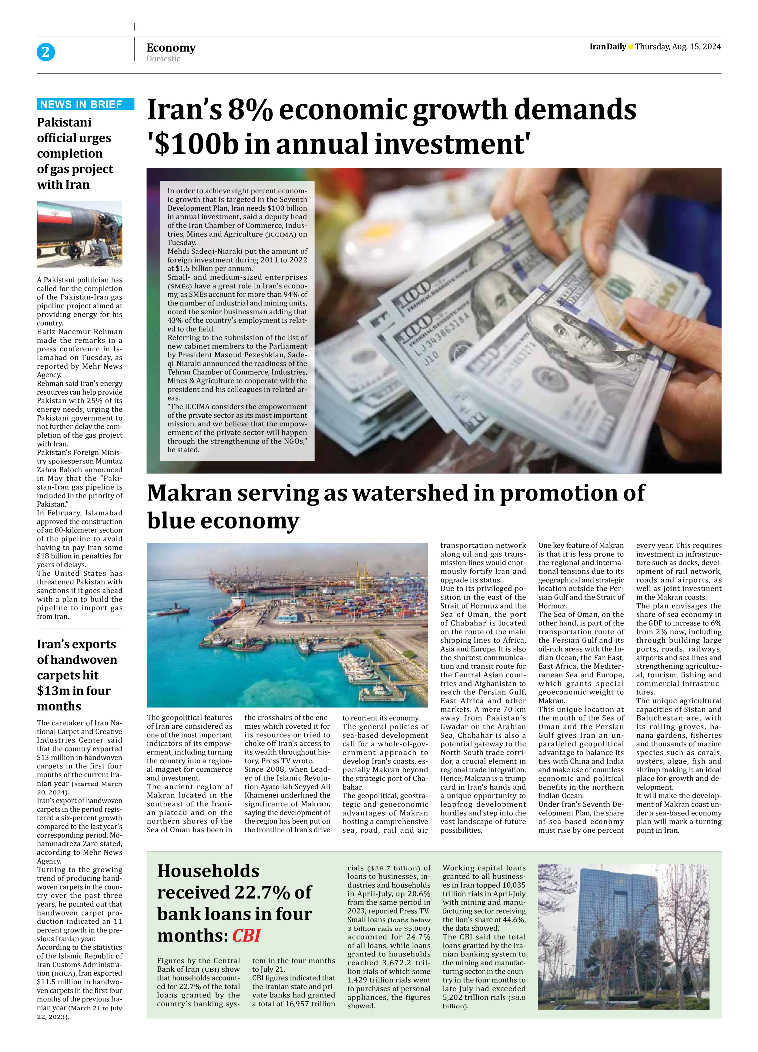
Due to its privileged position in the east of the Strait of Hormuz and the Sea of Oman, the port of Chabahar is located on the route of the main shipping lines to Africa, Asia and Europe. It is also the shortest communication and transit route for the Central Asian countries and Afghanistan to reach the Persian Gulf, East Africa and other markets. A mere 70 km away from Pakistan’s Gwadar on the Arabian Sea, Chabahar is also a potential gateway to the North-South trade corridor, a crucial element in regional trade integration.
Hence, Makran is a trump card in Iran’s hands and a unique opportunity to leapfrog development hurdles and step into the vast landscape of future possibilities.
One key feature of Makran is that it is less prone to the regional and international tensions due to its geographical and strategic location outside the Persian Gulf and the Strait of Hormuz.
The Sea of Oman, on the other hand, is part of the transportation route of the Persian Gulf and its oil-rich areas with the Indian Ocean, the Far East, East Africa, the Mediterranean Sea and Europe, which grants special geoeconomic weight to Makran.
This unique location at the mouth of the Sea of Oman and the Persian Gulf gives Iran an unparalleled geopolitical advantage to balance its ties with China and India and make use of countless economic and political benefits in the northern Indian Ocean.
Under Iran’s Seventh Development Plan, the share of sea-based economy must rise by one percent every year. This requires investment in infrastructure such as docks, development of rail network, roads and airports, as well as joint investment in the Makran coasts.
The plan envisages the share of sea economy in the GDP to increase to 6% from 2% now, including through building large ports, roads, railways, airports and sea lines and strengthening agricultural, tourism, fishing and commercial infrastructures.
The unique agricultural capacities of Sistan and Baluchestan are, with its rolling groves, banana gardens, fisheries and thousands of marine species such as corals, oysters, algae, fish and shrimp making it an ideal place for growth and development.
It will make the development of Makran coast under a sea-based economy plan will mark a turning point in Iran.