


Iranian satellites to contribute to environmental pursuits
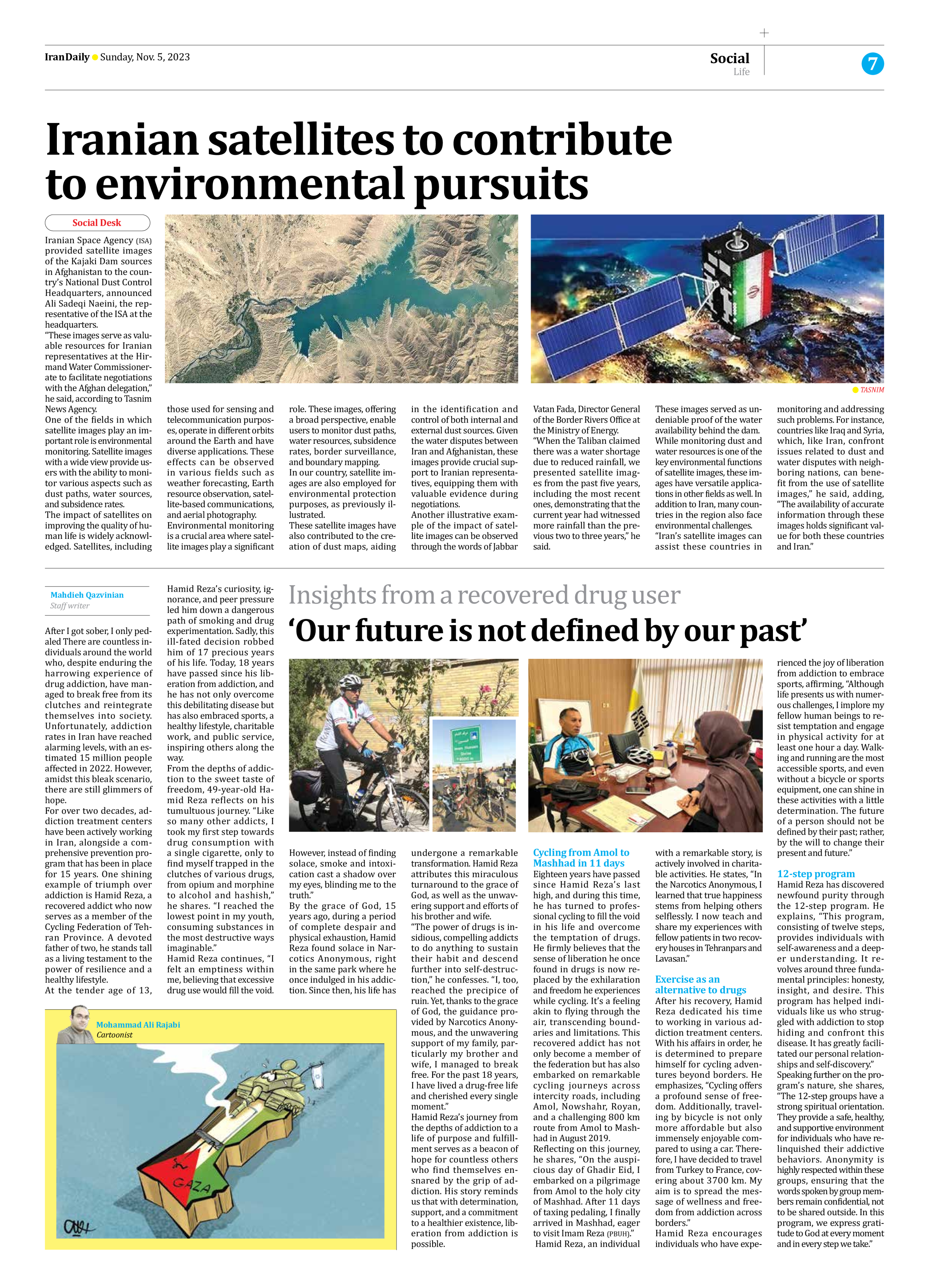
Iranian Space Agency (ISA) provided satellite images of the Kajaki Dam sources in Afghanistan to the country’s National Dust Control Headquarters, announced Ali Sadeqi Naeini, the representative of the ISA at the headquarters.
“These images serve as valuable resources for Iranian representatives at the Hirmand Water Commissionerate to facilitate negotiations with the Afghan delegation,” he said, according to Tasnim News Agency.
One of the fields in which satellite images play an important role is environmental monitoring. Satellite images with a wide view provide users with the ability to monitor various aspects such as dust paths, water sources, and subsidence rates.
The impact of satellites on improving the quality of human life is widely acknowledged. Satellites, including those used for sensing and telecommunication purposes, operate in different orbits around the Earth and have diverse applications. These effects can be observed in various fields such as weather forecasting, Earth resource observation, satellite-based communications, and aerial photography.
Environmental monitoring is a crucial area where satellite images play a significant role. These images, offering a broad perspective, enable users to monitor dust paths, water resources, subsidence rates, border surveillance, and boundary mapping.
In our country, satellite images are also employed for environmental protection purposes, as previously illustrated.
These satellite images have also contributed to the creation of dust maps, aiding in the identification and control of both internal and external dust sources. Given the water disputes between Iran and Afghanistan, these images provide crucial support to Iranian representatives, equipping them with valuable evidence during negotiations.
Another illustrative example of the impact of satellite images can be observed through the words of Jabbar Vatan Fada, Director General of the Border Rivers Office at the Ministry of Energy.
“When the Taliban claimed there was a water shortage due to reduced rainfall, we presented satellite images from the past five years, including the most recent ones, demonstrating that the current year had witnessed more rainfall than the previous two to three years,” he said.
These images served as undeniable proof of the water availability behind the dam.
While monitoring dust and water resources is one of the key environmental functions of satellite images, these images have versatile applications in other fields as well. In addition to Iran, many countries in the region also face environmental challenges.
“Iran’s satellite images can assist these countries in monitoring and addressing such problems. For instance, countries like Iraq and Syria, which, like Iran, confront issues related to dust and water disputes with neighboring nations, can benefit from the use of satellite images,” he said, adding, “The availability of accurate information through these images holds significant value for both these countries and Iran.”